PTx Trimble
  • Solutions
    • Solutions
    • Workflows
      • Workflows
      • Land Preparation
      • Planting & Seeding
      • Crop Protection
    • Additional Solutions
      • Additional Solutions
      • Correction Services
      • ISOBUS
      • Enterprise
  • Products
    • Products
    • All Products
    • Hardware
      • Hardware
      • All Hardware
      • Displays
PTx Trimble
  • Solutions
    • WORKFLOWS

    • ADDITIONAL SOLUTIONS

    • Overview
    • Correction Services
    • Land Preparation
    • ISOBUS
    • Planting & Seeding
    • Enterprise
    • Crop Protection
    • Sustainability
    • Nutrient Management
    • Water Management
    • Harvest
  • Products
    • HARDWARE

    • SOFTWARE & APPS

    • CORRECTION SERVICES

    • All Hardware
    • All Software & Apps
    • Correction Services
    • Displays
    • Trimble Ag Software
    • Guidance Control
    • Advisor Prime
    • Steering Systems
    • Data Warehouse
    • Flow & Application Control
    • Land Forming
    • Land Forming
    • Subsurface Drainage
    • Subsurface Drainage
  • Support
  1. How-to Central
  2. Search Results
  3. View map types on the mobile app

View map types on the mobile app

Switch between standard, satellite or hybrid view when referring to field boundaries on Trimble Ag Mobile. Use these map features on any field on the mobile app, starting from the home screen’s Field tile or Farm tile.


  1. Log in to the mobile app with the same Trimble ID used to access your online account (learn more)
  2. From the mobile app’s home screen, select the preferred crop year (top left)
  3. Tap the Fields tile
  4. Tap the full-screen  icon to expand the map view
  5. Tap the compass  icon to show your current location (only use if you’re close to the field boundary)
  6. Tap the map type  icon to Select Map Type

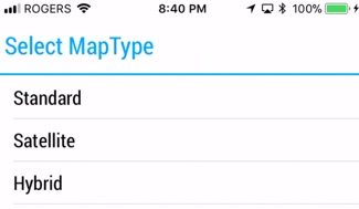
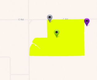
    • Standard – view map background in white as a road map
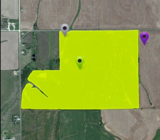
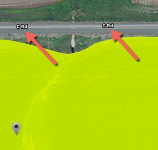
    • Satellite (default) – view map background in colour as aerial photography
    • Hybrid – view a combination of standard and satellite maps to see street names over colour aerial photography (pinch screen to zoom in)

Search How-To Central:

How-To Central Categories

Support
Get your questions answered
Authorized dealers
Locate or contact Trimble resellers
Careers
Work at Trimble
SOLUTIONS
  • Land Preparation
  • Planting & Seeding
  • Crop Protection
  • Nutrient Management
  • Water Management
  • Harvest
PRODUCTS
  • Displays
  • ISOBUS Compatible Input Control
  • Record-Keeping
  • Crop Planning
  • Yield Monitoring
  • Farm Finance Management
  • Advanced Positioning
  • Land Forming
PARTNERS
  • Support
  • How to Buy
  • Privacy Policy
  • Do Not Sell My Personal Information
SUPPORT
  • Contact Trimble
  • Resources
  • Release Notes
  • Facebook – Trimble Agriculture logo
  • Instagram – @trimble_ag logo
  • Twitter – @trimble_ag logo
  • LinkedIn – Trimble Agriculture logo
  • YouTube – Trimble Agriculture logo
Trimble Logo
© 2023, Trimble Inc.

Trimble is an industrial technology company transforming the way the world works by delivering solutions that enable our customers to thrive. Core technologies in positioning, modeling, connectivity and data analytics connect the digital and physical worlds to improve productivity, quality, safety, transparency and sustainability. From purpose built products to enterprise lifecycle solutions, Trimble is transforming industries such as agriculture, construction, geospatial and transportation.

  • Legal
  • Terms of Use
  • Terms of Sale
  • Privacy Center
  • Do Not Sell My Information
  • English