Crop Health Imagery
Crop Health Imagery, powered by PurePixel™ technology, provides reliable, cloud-free, calibrated satellite images to farmers and their trusted advisors. PurePixel leverages a proprietary algorithm to analyze multiple sensor inputs to produce calibrated vegetative index maps throughout the growing season. This unique calibration allows farmers to compare crop health at each growing stage for more targeted crop scouting.
Learn More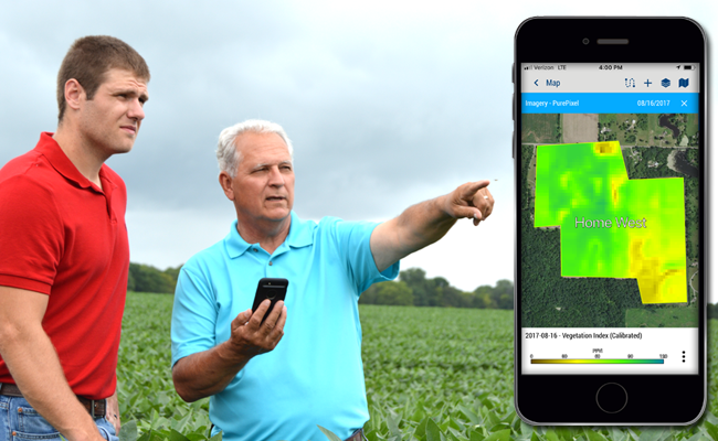
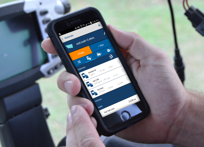
Work Orders
The Work Orders feature takes the guesswork out of assigning and tracking field work for farm managers. This easy-to-use mobile feature assists in managing logistics, assigning tasks, tracking progress, and making quick adjustments to maximize efficiency and farm productivity. In addition, farm workers can leverage their smartphone to receive daily tasks, resulting in increased efficiency and a reduction in application mistakes.
Learn MoreSoil Sampling
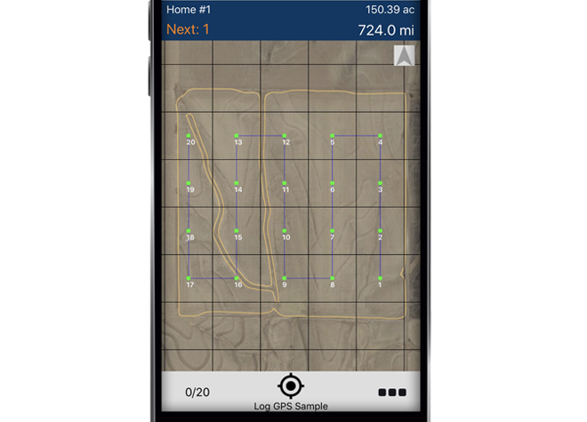
When it comes to soil sampling, no other app makes the process easier. Create grids on the fly or display background zones for each field. See where you logged the actual point and send all data back to your computer without worrying about USB sticks or cables.
With our mobile app you can:
- Create any grid size
- Load background zone maps
- Navigate to target points
- Complete work without an internet connection
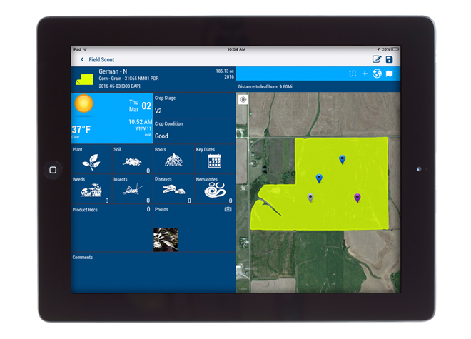
Crop Scouting
Entering crop scouting notes and taking images of pests has never been easier. The best part? Multiple users can enter crop scouting records at the same time, sending data back to one central location. Quickly analyze the results and create recommendations in a timely manner.
With our mobile app you can:
- Pick from pre-populated pest and weed lists
- Share real-time reports
- Capture photos and tag them to scouting job
- Complete work without an internet connection
Product Comparison
| Farmer Fit | Farmer Pro | |
|---|---|---|
| Login users | Up to 2 Users | Up to 5 Users |
| Dashboard for weather forecasting and commodity price tracking1 | ✔ | ✔ |
| Includes desktop farm management software with basic accounting | ✔ | ✔ |
| Enter detailed field records for seed, spray, fertilizer, harvest and other applications | ✔ | ✔ |
| Import/export data to/from precision farming displays | ✔ | ✔ |
| Process yield data with yield cleaning tool | ✔ | ✔ |
| Add materials and track purchases and usage by field with costs | ✔ | ✔ |
| Print reports on seed, fertilizer, chemical usage and more | ✔ | ✔ |
| See profitability by field and farm | ✔ | ✔ |
| Manage guidance lines | ✔ | ✔ |
| Wireless vehicle connections with Trimble displays2 | 1 | 2 |
| Track fleet locations, status and utilization reports | ✔ | ✔ |
| Connect to third-party displays for wireless data transfer (via API) | ✔ | ✔ |
| Enter and view field records, re-entry alerts, and basic mapping with the mobile app | ✔ | ✔ |
| Use drawing tools to lay out management zones based on yield and other map data | ✔ | ✔ |
| Create simple VRA prescription maps using yield or any other precision ag display data | ✔ | ✔ |
| Includes software training to assist getting started3 | ✔ | ✔ |
| Includes 1 year of software updates and technical support | ✔ | ✔ |
| Additional modules for field specific weather4 and employee time tracking | ✔ | ✔ |
| Grid or zone soil sampling workflow including mobile app navigation | ✔ | |
| Track bin inventory | ✔ | |
| Manage grain contracts and market position statements | ✔ | |
| Log scouting data and create recommendations | ✔ | |
| Create and assign Work Orders and monitor the status of each | ✔ | |
| View Crop Health Imagery for each field5 | ✔ | |
| Import UAV imagery | ✔ |
1Cash bid prices available only in the United States.
2Vehicle Connections allow you to connect to a Trimble display for fleet tracking and wireless data transfer using Trimble modems & data plans or a third-party USB Wi-Fi adapter. Additional vehicle connections can be purchased for a fee.
3Complimentary remote training is available in English, expanding to other languages in the future.
4Ag Premium Weather is available in North America but expanding to other regions in 2019.
5Includes up to 10,000 acres of Crop Health Imagery. Additional acres can be purchased by reaching out to sales at 1-800-282-4103.